
Communities
We Specialize In The Following Areas
Commiunities
We Serve

ALVARADO ESTATES
The exclusive hilltop residential development overlooking Mission Valley and Grantville was conceived by noted San Diego architect Lloyd Ruocco, and first subdivided in 1948. Avion Street is aptly named as it was originally an airstrip thought to be needed for the targeted “professional” residents whom might own private aircraft. Some impressive examples of San Diego’s most notable Modernist residential architecture can be found in Alvarado Estates; including homes designed by Richard Neutra, Henry Hester, and Lloyd Ruocco. Alvarado Estates is the only private, gated community within the College Neighborhoods

ALLIED GARDENS
Allied Gardens is a charming neighborhood located in San Diego, California. Developed in the 1950s, it boasts a tranquil suburban atmosphere with tree-lined streets and well-maintained homes. The area is known for its strong sense of community and family-friendly environment, with excellent schools and parks nearby. Allied Gardens offers residents convenient access to shopping centers, restaurants, and outdoor recreational areas, making it a desirable place to live for individuals and families alike.

COLLEGE VIEW ESTATES
College View Estates is conveniently located near Interstate 8 and adjacent to a trolley stop. It is close to major shopping centers, excellent hospitals, and San Diego State University. College View Estates’ mid-century homes have large custom built homes in addition to a mix of three and four bedroom floor plans. Many of the homes have views of the surrounding canyons or hills.
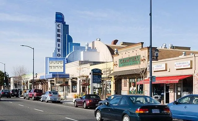
EL CERRITO
El Cerrito: Named after a hill between 55th and 58th Street, documented in the late 1800s. Development began in the 1890s with farm tracts like Redlands and Lemon Villa. The El Cerrito Park Water District was established in 1909. Suburban developers subdivided tracts in the 1920s. It grew with the establishment of San Diego State College in 1931. A Business District Association formed in the 1930s. Post-WWII, it saw growth with tract homes like Belleview Heights. Condominium projects emerged in the 1960s. Three historic houses are listed on the City of San Diego’s Historical Properties list.
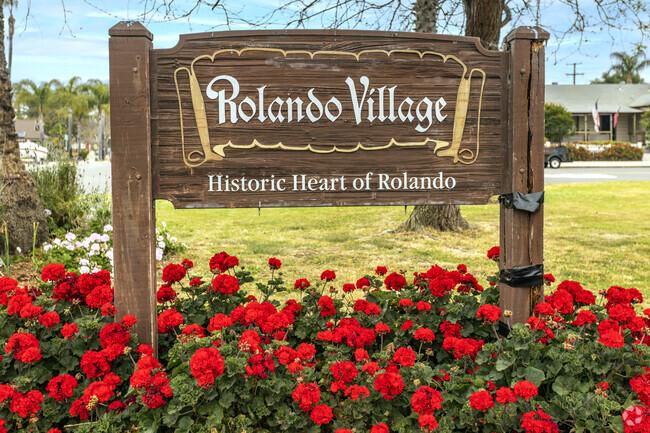
ROLANDO
In 1926, LA real estate developers teamed up with locals to create Rolando, named for its rolling landscape. The paving of University Avenue in 1925 spurred interest. It featured curving streets, decorative lights, and commercial areas. By 1930, it faced foreclosure but was revived in 1939. World War II brought a boom, filling the area with homes from 1939 to 1941. After the war, more subdivisions expanded westward. Rolando joined San Diego in 1954, with Henry Clay Elementary opening in 1957. The Rolando Street Fair is held annually in March.
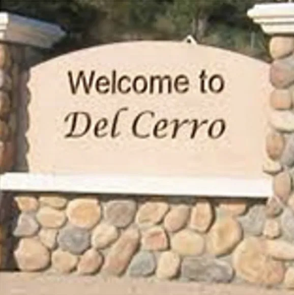
DEL CERRO
DEL CERRO Del CerroDel Cerro (Spanish for “of the hill”) is a wealthy residential neighborhood of approximately 2,300 residents in the eastern part of San Diego, California. Del Cerro borders the communities of San Carlos, Allied Gardens, College Area, Grantville, and the city of La Mesa, and is adjacent to Lake Murray and San Diego State University.
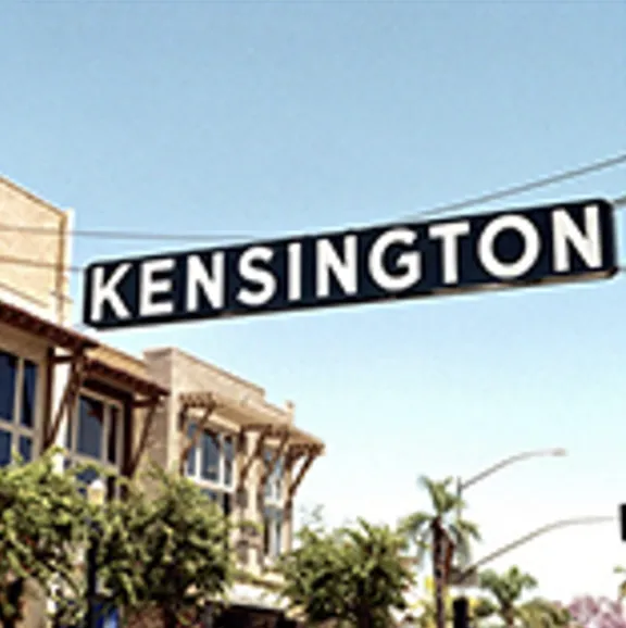
KENSINGTON
Tucked away just past Normal Heights, along the hip and fabulous Adams Avenue, Kensington is a quitter, quainter and more luxurious neighborhood, rooted deeply in history. Formed in the early 1900’s, and stocked full of Craftsman and Revival style homes by Richard Requa and Cliff May, and more modern classics such as by Allard Jansen, Jim Brown, and Jim Gates, this 5 block stretch boarders I-15 on one side, I-8 to the north, Fairmount Ave to the east, and El Cajon Blvd to the south. Many street and businesses featured English names, as does the name Kensington itself. The area feels like a well kept small town, and has maintained that feel since it was founded. There are many annual traditions and festivals held by the community and residents alike, such as the Memorial Day Parade, 4th of July Block Party, and street parties held by residents themselves. Casual dining, wine bars, and boutiques line this stretch of Adams Ave, local residents frequent the businesses here, and are happy to call it home.
SAN CARLOS
San Carlos is an upper-middle-class neighborhood in the eastern area of San Diego, California. It borders the neighborhoods of Del Cerro,Tierrasanta, and Allied Gardens, the city of La Mesa, and Mission Trails Regional Park. The “jewel” of San Carlos is Cowles Mountain. San Carlos is geographically defined largely by its proximity to Mission Trails Regional Park and to the man-made reservoir Lake Murray. The area consists primarily of single-family homes.

TALMADGE
Talmadge is a neighborhood of the mid-city region of San Diego, California. Its borders are defined by Fairmount Avenue to the West, Montezuma Road/Collwood Boulevard to the Northeast, and El Cajon Boulevard to the South. The architecture in Talmadge is eclectic, with styles including Spanish Revival, California bungalows, Cape Cod cottages and Normandy Style homes. Cliff May, a renowned Southern California architect, designed several homes in Talmadge.
PACIFIC BEACH
Pacific Beach, commonly referred to as PB by locals, is a vibrant coastal community nestled in San Diego, California. Known for its beautiful sandy beaches, bustling boardwalk, and lively atmosphere, Pacific Beach attracts residents and visitors alike seeking sun, surf, and entertainment. The area offers an eclectic mix of trendy bars, restaurants, and shops, making it a popular destination for young professionals, students, and tourists. With its laid-back beach vibe and year-round pleasant weather, Pacific Beach is a haven for outdoor enthusiasts, offering opportunities for surfing, biking, and beach volleyball. Whether strolling along the boardwalk, catching a wave, or enjoying a sunset over the Pacific Ocean, Pacific Beach encapsulates the quintessential Southern California beach lifestyle.

MISSION BEACH
Mission Beach, situated in San Diego, California, is a picturesque coastal neighborhood renowned for its pristine beaches and lively ambiance. Flanked by Mission Bay to the east and the Pacific Ocean to the west, this vibrant community offers an array of recreational activities such as swimming, surfing, and beach volleyball. The iconic Belmont Park amusement park adds to the area's charm, featuring the historic Giant Dipper roller coaster and a variety of rides and attractions. With its scenic boardwalk lined with shops, eateries, and bars, Mission Beach attracts locals and tourists alike, creating a dynamic atmosphere day and night. Whether enjoying a leisurely bike ride along the coast or savoring fresh seafood with ocean views, Mission Beach embodies the quintessential Southern California beach experience.
Hidden Luxury in Alvarado Estates
Alvarado Estates, a neighborhood nestled amidst the scenic beauty of San Diego, is a hidden gem that boasts luxury living at its finest. ...more
Real Estate
February 20, 2024•4 min read
OUR TEAM

TESTIMONIALS
CUSTOMER REVIEWS
JANE DOE

I can't express enough how [Your Company Name] has transformed my real estate investment journey. The platform's intuitive interface, expert guidance, and access to exclusive deals have been invaluable.
JOHN DOE

As a newcomer to real estate wholesaling, I was initially overwhelmed by the complexity of the market. [Your Company Name] changed everything for me. Their educational resources, step-by-step guidance.
Get In Touch
FAQS
What is the role of a real estate agent in the home buying/selling process?
Answer: Real estate agents play a crucial role in facilitating the buying and selling of properties. They assist buyers in finding suitable homes, negotiate offers, and guide them through the complex paperwork involved in the transaction. For sellers, agents help market the property effectively, attract potential buyers, negotiate the best price, and ensure a smooth closing process. Their expertise in the local market, negotiation skills, and understanding of legalities make them invaluable partners in real estate transactions.
How does the probate process impact real estate transactions?
Answer: The probate process can significantly influence real estate transactions, especially when dealing with properties owned by deceased individuals. When a property owner passes away, their estate typically goes through probate, which is the legal process of validating their will, paying off debts, and distributing assets to heirs. Real estate transactions involving probate properties often require court approval, thorough documentation, and sometimes additional steps to clear title issues. Working with an experienced real estate agent or attorney familiar with probate proceedings can streamline the process and mitigate potential complications.
What are the advantages of using a trust for real estate planning?
Answer: Utilizing a trust for real estate planning offers several advantages, including privacy, probate avoidance, and efficient asset distribution. By transferring ownership of real estate into a trust, individuals can maintain confidentiality since trust documents are not public records like wills filed in probate court. Moreover, assets held in a trust can bypass the probate process, saving time and costs associated with probate administration. Additionally, trusts allow for more control over how and when beneficiaries receive inheritances, enabling customized asset management and protection.
What are some common types of trusts used in real estate planning?
Answer: Several types of trusts are commonly used in real estate planning, each serving different purposes based on individual needs and goals. Revocable living trusts, for instance, provide flexibility and control during the grantor's lifetime, allowing them to transfer real estate assets while retaining the ability to modify or revoke the trust as circumstances change. Irrevocable trusts, on the other hand, offer asset protection and potential tax benefits, as assets transferred into these trusts are typically shielded from creditors and estate taxes. Other specialized trusts, such as Qualified Personal Residence Trusts (QPRTs) or Land Trusts, may also be utilized for specific real estate planning objectives.
How does real estate ownership differ in a trust compared to personal ownership?
Answer: Real estate ownership through a trust differs from personal ownership in several key aspects. When property is held in a trust, legal title is vested in the trust entity rather than the individual owner's name. This distinction offers benefits such as probate avoidance, potential tax advantages, and streamlined asset management. Additionally, trusts provide continuity of ownership, ensuring seamless transfer of property to beneficiaries upon the grantor's passing, without the need for court intervention or probate proceedings. Trust-owned real estate may also offer increased privacy and asset protection compared to individually owned properties.
What steps are involved in transferring real estate into a trust?
Answer: Transferring real estate into a trust typically involves several key steps to ensure proper legal and financial considerations are addressed. Firstly, the trust document must be drafted, specifying the property to be transferred and naming the trust beneficiaries. Next, a deed is prepared to transfer ownership of the property from the individual owner to the trust. This deed must comply with state laws and include specific language referencing the trust agreement. Once executed, the deed is recorded with the appropriate county or municipal office to formalize the transfer. Finally, it's essential to update insurance policies, mortgage agreements, and property tax records to reflect the trust ownership.
What factors should be considered when choosing a trustee for a real estate trust?
Selecting the right trustee for a real estate trust is a critical decision that requires careful consideration of various factors. A trustee should be someone trustworthy, competent, and capable of managing the responsibilities associated with administering the trust and its assets. Consideration should be given to the trustee's financial acumen, organizational skills, availability, and willingness to fulfill fiduciary duties. Additionally, factors such as the trustee's relationship with beneficiaries, potential conflicts of interest, and longevity should be evaluated to ensure the chosen trustee aligns with the grantor's intentions and the long-term objectives of the trust. Consulting with legal and financial advisors can help navigate this decision-making process effectively.
Stay In The Loop!
I agree to terms & conditions provided by Papitto Properties Inc. By providing my phone number, I agree to receive text messages from the business.